Showing posts with label Around the Sound. Show all posts

Friday, September 8, 2017

Eyes Over Puget Sound: Sunny, warm and colorful

Late summer brings warm air temperatures, abundant sunshine and drier conditions throughout Puget Sound. Stream flows in the region’s northern rivers are lower than our rivers in south Puget Sound.

Click here to see this month's report


Yet, the combination of abundant spring rain and weak upwelling from the Pacific Ocean means Puget Sound waters are still fresher than at any time in the past 17 years.

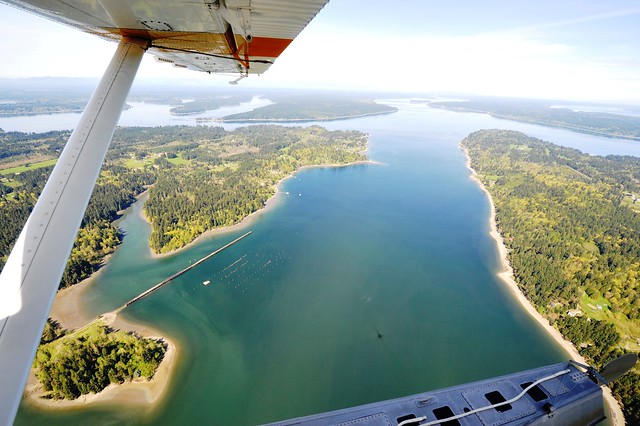
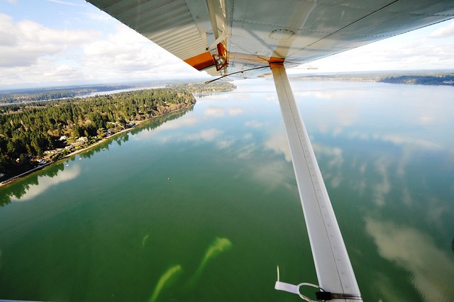
While the abundance of jellyfish is lower this year, our warm water temperatures, especially in central Puget Sound, are accompanied by large rafts of drifting macroalgae. What else did we see on our Eyes Over Puget Sound overflight? Diverse blooms in colors of green, orange and red-brown in many our inlets.

We are also checking to see how if our benthic invertebrate community is changing. We are monitoring and measuring samples of these critters that live in the sediments of Puget Sound at our long-term monitoring stations. We’re gathering information so we have baselines to see if any long-term change is occurring among this sensitive part of the Puget Sound ecosystem.

This year, we’re getting great hands-on assistance from our Washington Conservation Corps intern, Nicole Marks. To see more about the project, check out the great poster Nicole has created.

Friday, June 9, 2017

Eyes Over Puget Sound: River flows above normal

Cooler and wetter conditions earlier this year have set the stage for a favorable supply of freshwater. River flows are all above normal due to warm May temperatures melting our abundant snow pack. These conditions are creating significantly fresher conditions in Puget Sound surface waters. 

Click here to see this month's report.


Algae blooms are limited but there are some yellow-green blooms growing in bays near the Kitsap Peninsula and in the Puyallup, Skagit and Stillaguamish river estuaries. Red algae blooms are present in the rivers feeding into Willapa Bay. Also see what is “blooming” in the sediments of Puget Sound.

What's Eyes Over Puget Sound?

Eyes Over Puget Sound combines high-resolution photo observations with satellite images, ferry data from travel between Seattle and Victoria BC, and measurements from our moored instruments. We use a seaplane to travel between our monitoring stations because they are so far apart. Once a month, we take photos of Puget Sound water conditions and turn those out, along with data from our stations, in the monthly Eyes Over Puget Sound report.

Wednesday, January 18, 2017

Eyes Over Puget Sound: A look at 2016 in photos

After two years of very warm air and record-high water temperatures, Puget Sound is close to normal. Between the Blob warming our waters in 2015 and the past year of El Niño, we're still a bit warmer than usual, but we're in better shape than we've seen in some time.


Learn about how the global climate affects water quality, see the impacts warmer waters had on the Sound and compare photos from flights throughout 2016 in this year-end summary.

Nov. 2016 - Squaxin Passage
Feb. 2016 - Willipa Bay


We had some major rains this year! They sent mud and runoff into our rivers, downstream and out into the Sound. 2016 began and ended with sediment dynamically painting our waters.

Sept. 2016 - Liberty Bay


The very low summer river flows we experienced last year reflected climate predictions for the northwest. Our rivers are like a cold faucet: turned up high, their flow keeps waters cool, moving and full of oxygen. With the river taps turned way down, marine waters don't get mixed as much which causes warmer temperatures and higher salinities. As a result, we saw abundant jellyfish, floating macro-algae and Noctiluca blooms.

Sept. 2016 - Budd Inlet
Aug. 2016 - Eld Inlet


Surprisingly, only south Puget Sound developed very low summer oxygen levels in 2016. By fall, La Niña came with a punch! This brought more rain and cool air temperatures. But the question remains: will this be an unusual La Niña?

July 2016 - Edmonds Underwater Park

What's Eyes Over Puget Sound?


Eyes Over Puget Sound combines high-resolution photo observations with data from our monthly monitoring stations, from our regional partners and from instruments we have on ferries. We use a seaplane to travel between many of our monitoring stations because they are so far apart.

Once a month, we take photos of Puget Sound water conditions and turn those out, along with data from our stations, in the monthly Eyes Over Puget Sound report.

Tuesday, December 6, 2016

Eyes Over Puget Sound: La Niña is here!

With La Niña present we are seeing wetter and warmer conditions. Heavy rains in October swelled Puget Sound rivers and streams to above normal levels. As a result, water temperatures, salinities and oxygen in Puget Sound are returning to normal.

EOPS report cover and text for Nov. 22, 2016 report
Click here to read the November report.


While surface water in Puget Sound has cooled, it is still warmer than in the Straits.

I can see clearly now

We continue to see large groups of jellyfish in finger Inlets of South Sound and slowly fading red-brown blooms in Eld and Budd Inlets. A lot of suspended sediment was observed east of Steamboat Island and south of Squaxin Island. Otherwise, we have clear water.

What is Eyes Over Puget Sound?

Eyes Over Puget Sound combines high-resolution photo observations with data from our monthly monitoring stations, from our regional partners and from instruments we have on ferries. We use a seaplane to travel between many of our monitoring stations because they are so far apart.

Once a month, we take photos of Puget Sound water conditions and turn those out, along with data from our stations, in the monthly Eyes Over Puget Sound report.

Thursday, August 18, 2016

Proposed amendments of University Place shoreline plan ready for public input

University Place’s proposed update to its Shoreline Master Program is ready for public comment now through Sept. 1, 2016. The proposed amendment provides consistency with the Growth Management Act’s mandate that local governments use the best available science in their critical areas ordinances. This type of amendment is not unusual.

What’s a Shoreline Master Program?

Shoreline Master Programs are local plans developed by cities and counties to manage shoreline use. These local programs protect natural resources for future generations, provide for public access to public waters and shores, and plan for shoreline uses and development.


University Place’s shoreline plan

University Place’s new amendments are related to wetland buffers and mitigation, as well as geological hazardous areas and their associated buffers. 

To schedule a time to read paper copies of the proposal, contact the City of University Place, or contact Ecology Regional Planner Michelle McConnell at the address below.

All comments should be sent to Michelle McConnell. There are four ways to do it:
By email:             michelle.mcconnell@ecy.wa.gov

By mail:               Southwest Regional Office
                             PO Box 47775
                             Olympia, WA 98504-7600

In person:            300 Desmond Drive
                              Lacey, WA 98503

By phone:            360-407-6349


Ecology must receive comments no later than 5 p.m. Sept. 1, 2016.

Comment summaries and the city’s response will be posted to the University Place Shoreline Master Program page on Ecology’s website.


By: Dave Bennett, Southwest Region communications manager

Tuesday, July 12, 2016

Cleaning Up: From RAGs to (environmental) riches

Ecology passes nearly 70 percent of the agency's $1.4 billion budget directly to local communities and governments.
The Port of Everett is using a Remedial Action Grant for a dredging project.

That money pays for a variety of other environmental work -- cleaning up contaminated sites, managing polluted stormwater runoff, preventing floods, managing garbage and wastewater, and more.

Remedial Action Grants, or RAGs, are significant tools for cleanups. Local governments -- port districts, cities, counties, and others -- use the grants to help reimburse some of their costs for cleaning up publicly owned properties.

Grants encourage cleanup


Cleanups aren't cheap -- they can cost tens of millions of dollars. By providing Remedial Action Grants, our Toxics Cleanup Program encourages environmental cleanup and supports local governments that want to redevelop contaminated properties they own. Funding for the grants comes from a voter-approved tax on hazardous substances as provided in the state's cleanup law, the Model Toxics Control Act.

Skagit County is using an old truck stop site for a new jail.
Without such aid, local governments might put off cleanup projects because of the expense. The grants give public entities confidence that they won't take on the entire project cost alone. (Local governments can also receive payments from former property owners or others who contributed to the pollution at a site, and from insurance policies.)

Typically, the grants reimburse 50 percent of a public entity's eligible costs. But reimbursement could go as high as 90 percent, if the local government is located in an area that's designated as "economically distressed."

Skagit County is one of the local governments using a 90 percent RAG. The county searched for a site for a new jail and eventually settled on the former Truck City truck stop site in south Mount Vernon.

Work is continuing on the new Skagit County jail.
The county bought the site in 2015. Truck City had operated for more than 30 years, with an on-site gas station, underground fuel storage tanks, truck weigh station, washing facilities, and more.

Activities at the site left pollution behind, so the county received a Remedial Action Grant to help pay for cleanup. The county's new jail is on track to open in spring 2017.

Clearing the way


Skagit County is just one example of a Remedial Action Grant in action. Dozens of the grants support projects in motion throughout the state, and helped fund completed projects.

Dredging will remove contamination around Pacific Terminal.
In Snohomish County, the Port of Everett is getting ready to start a dredging project at the former Weyerhaeuser Mill A site on Port Gardner Bay.

The dredging will remove tons of contaminated sediments from the water, plus improve navigational access to the port's Pacific TerminalThe port uses the site for handling cargo for construction and manufacturing industries, including parts for The Boeing Co.’s jetliners.

Work is expected to start in August and continue into the fall.

By Seth Preston, Toxics Cleanup Program communications manager

Tuesday, July 5, 2016

Eyes Over Puget Sound: Diving into warmer waters

Summer is officially here, and it is bringing record-breaking Puget Sound water temperatures along for the ride. What could this mean for you? First, join us for the BEACH program kick-off in the June Eyes Over Puget Sound report.

Click to view the June report here


Is my beach safe for swimming?

Each year between Memorial Day and Labor Day, the Washington State BEACH Program monitors saltwater beaches to make sure conditions are safe for swimming and other recreational activities.

Media joined the monitoring teams last month for a kick-off to find out more about the condition of our favorite beaches and how to help keep them healthy.

Follow us on Facebook and Twitter for beach water quality updates, or visit our BEACH Program website for more information on beaches near you.

Visibility conditions for divers

Our monitoring team brings you a new feature: water visibility at different locations around Puget Sound. If you’re thinking of grabbing your scuba gear this weekend, take a look at our map to find out where underwater visibility is highest or lowest.

Visibility might be lower than in previous months. This new section will eventually deliver present conditions. We’d love to hear your feedback on it!

What does recent rain mean for water quality in Puget Sound?

Fortunately, rivers are now flowing at higher levels compared to last year’s drought. Still, we are missing a lot of the snow to support summer flows.

Visit our Flickr album for more photos from this month's Eyes Over Puget Sound report.

Despite recent rainfall the Fraser River has not been flowing nearly as high as last year, a year of drought. Why does this matter? The Fraser River, the longest river within British Columbia, is also the largest freshwater source for the Salish Sea.

Low flow in Fraser River means the water isn’t circulating as much as the Salish Sea does in normal years. Stagnant, or motionless, water means warm temperatures will continue, pollution will increase, and jellyfish could continue to appear in large numbers.

What about the jellies?

During sea plane flights over Puget Sound, we also observed many “smacks,” or groups of jellyfish. You can see high numbers of them in Eld and Totten Inlets in the South Sound region.

Phytoplankton blooms and large mats of floating organic material also showed up east of Bainbridge Island and Port Madison, as well as Quartermaster Harbor near Vashon Island.

Ew…what’s that smell?

Plug your nose before meeting our latest Critter of the Month! The Pacific Stinkworm, Travisia pupa, smells like rotting garlic when disturbed. 

Though not as easy on the eyes as last month’s critter, Travisia pupa plays an important role on the muddy ocean bottom. The Pacific Stinkworm, also known as the Pupa Utility Worm, helps aerate material on the ocean floor by burrowing and turning over sediment as it feeds. Visit our Critter of the Month blog series for more.

What's Eyes Over Puget Sound?

Eyes Over Puget Sound combines high-resolution photo observations with satellite images, ferry data from travel between Seattle and Victoria BC, and measurements from our moored instruments. We use a seaplane to travel between our monitoring stations because they are so far apart. Once a month, we take photos of Puget Sound water conditions and turn those out, along with data from our stations, in the monthly Eyes Over Puget Sound report.

Friday, July 1, 2016

Around the Sound: Port Gamble Bay cleanup restarting

Cleanup, including pulling out old pilings, is restarting at Port Gamble Bay in Kitsap County.

The second round of Port Gamble Bay cleanup is gearing up.

Contractors are already setting up and starting some preliminary work, like stockpiling capping materials and pulling out pilings, as they prepare for the second year of cleanup work. This phase of cleanup will run through January 2017. It  follows the work that occurred from fall 2015 through January 2016.

The cleanup is focusing on chemical contamination and wood waste left by more than a century of industrial activities. From 1853 to 1995, the Pope & Talbot sawmill operated on the shores of the bay. After the mill closed, the company's resources were acquired by current site owner Pope Resources. The site was used for handling, sorting and storing logs and materials.

Port Gamble Bay is identified as one of several priority areas under the Puget Sound Initiative, which is an effort to improve and restore the Sound's health and habitat.

Pope Resources is responsible for the cleanup, under the oversight of Ecology's Toxics Cleanup Program.


What's happening


The summer months of the construction season will be focused on pile pulling, demolishing old structures and using about 33,000 cubic yards of clean material to cap a 61‐acre area in the central bay south of the former mill site. Bank excavation and debris removal are also planned.

Piling and dock removal at the former log transfer facility is scheduled to start July 18. A small area within the Port Gamble Forest Heritage Park -- the park access point  and parking adjacent to the shoreline (south and east of the trail access parking) -- will close for about three weeks. A sign is posted. The upland trails will remain open.

In the fall and winter months, dredging and follow‐up capping will move into high gear. Work will move from south of the mill site to north of the mill site as the season progresses.

Watch for heavy truck traffic if you're visiting or passing through Port Gamble. And the mill site will be closed to the public because of construction hazards.


What's been done


Within the first year, cleanup crews:
  • Removed 3,312 pilings.
  • Excavated 19,098 cubic yards of intertidal sediments.
  • Dredged 22,360 cubic yards.
  • Removed and recycled 3,063 tons of steel, concrete and other debris.
  • Delivered 69,051 tons of clean capping and habitat materials.

Once finished, cleanup will have removed about 6,000 creosote pilings and overwater structures, excavated roughly 70,000 cubic yards of contaminated sediment and wood waste, and sand capped other wood waste areas.


Stay informed


Weekly construction updates and more information can be found online.

By Seth Preston, Toxics Cleanup Program communications manager

Wednesday, June 22, 2016

Cleaning Up: Cleanup transforms communities

Visitors enjoy the sunshine at a former Anacortes cleanup site.
Cleaning up pollution remakes our environment and reshapes communities in Washington.

Cleanup improves quality of life. It restores the environment, protects human health, puts people to work, and boosts the economy.

Want a good example? Take a look at the cleanup at the former Scott Paper mill in Anacortes.

The former Scott Paper mill location was identified as a key cleanup site under the Puget Sound Initiative in and around Fidalgo and Padilla bays. The bays have been damaged by historical industrial activities -- cleaning up and protecting these waterways and others is vital to restoring and protecting the Puget Sound ecosystem.

Production meant pollution


The Scott Paper pulp-and-paper mill in Anacortes in full operation.
The mill was a dominant part of manufacturing operations along the Fidalgo Bay shoreline for roughly a century. The mill began as a sawmill, then started operating as a pulp mill to produce paper goods.

Operations shut down in 1978. After that, parts of the site were used for various industrial purposes, including as a log yard, a staging area for oil-field equipment, and an assembly area for modular homes. 


Old lumber littered the shoreline.
All of those activities took their toll on the local environment.

Wood waste suffocated in-water creatures in sediments and littered the shoreline. Industrial chemicals, wood and various pollutants contaminated the soil and sediments.

Over the years, portions of the site were cleaned up. The northern portion of the site, owned by the Port of Anacortes, became a home to commercial and educational buildings.


The site is now a hub for recreational, commercial and educational activities.
They include the Northwest Educational Service District 189 center, the Northwest Center of Excellence for Marine Manufacturing and Technology, and a Northwest Career and Technical Academy campus.


From cleanup to community gem


Wood waste and contaminants were unearthed during cleanup.
The Port of Anacortes, working with Ecology, took on the final cleanup stage in 2009. The work targeted wood waste and contamination along the shoreline and the adjacent uplands.

The project lasted about two years. It was no small task to remove the mill's legacy of pollution -- the Scott Paper cleanup remains the largest such effort (in terms of size and cost) tackled under the Puget Sound Initiative.

Kayakers and a family use the restored beach on a recent day.
This ECOconnect post in May 2011 describes the celebration held at the expanded and upgraded Seafarers' Memorial Park at the mill site.

Now, five years later after cleanup work finished, the former Scott Paper site is in constant use for community gatherings, live music performances, kayaking, boating, and other activities. Residents and visitors stroll the esplanade where old wood lay abandoned.

It's a living, thriving example of how cleanup benefits our communities as well as our environment.


By Seth Preston, Toxics Cleanup Program communications manager

Thursday, June 2, 2016

Around the Sound: Gearing up for cleanup in Everett's East Waterway


Ecology natural resource scientist John Evered digs for shellfish along Everett's East Waterway.
Cleaning up a large-scale contaminated site can be a complex, expensive process.

Sometimes, though, the work starts on a very small scale.

So that's why a group Ecology staff members, consultants and others recently grabbed some shovels and buckets to start digging along East Waterway, part of Everett's Port Gardner Bay.
Littleneck clams are common in and around East Waterway.

They looked for the types and abundance of shellfish -- clams, oysters, mussels -- at some of the waterway's isolated beaches where someone could harvest the bivalves. They dug up and replaced about 275 shellfish in total.

Andy Kallus, who oversees Ecology's cleanup sites around Port Gardner Bay, said the recent dig turned up wood waste in the waterway's sediments. Wood waste smothers organisms in the sediments.

"A lot of the sediment was very black, which is indicative of a lack of oxygen," he said.

The work is just a preliminary step on a long path that will eventually lead to the environmental cleanup of East Waterway.

An industrial history


An aerial view in the 1930s.
Decades of industrial activities have contaminated land and in-water sediments in and around the waterway. It's one of 11 Port Gardner Bay sites targeted for cleanup under the Puget Sound Initiative.

Since the early 1900s, East Waterway has been used for industrial activities -- primarily for shipping and processing timber, pulp and alumina; deep-water shipping operations by the Port of Everett; and U.S. Navy activities. 

A number of environmental investigations beginning in the 1980s found marine sediments contaminated with metals, various chemicals and organic compounds, and high levels of wood waste.


Working with partners


Ecology signed a legal agreement called an agreed order with the Port of EverettKimberly-Clark Worldwide, and the Washington State Department of Natural Resources to study and identify hazardous substances in the waterway. This includes upland sources that could potentially release contaminants into the water.

The Navy's Everett shipyard is shown in the 1940s.
The port has owned and operated industrial sites along the waterway for decades. DNR manages and leases state-owned aquatic lands. Kimberly-Clark and its predecessors operated a large pulp-and-paper mill along the waterway for decades, before closing the mill in 2012. 

Ecology is talking with the Navy about a separate legal agreement for potential cleanup. During and after World War II, the Navy used the waterway as a shipyard. An active Navy homeport now operates in East Waterway.

What's next


Kallus said he is working with the port, Kimberly-Clark and DNR to put together a plan for collecting environmental data. That investigation will show the type and extent of contamination in the waterway, as well as potential contamination that could reach the water from nearby upland sources.

Ecology will ask the public to comment on the investigation and collected data, plus possible options for cleaning up the waterway and controlling upland sources.

A harbor seal enjoys the sunshine while resting on the rafting logs near a Navy vessel in East Waterway.

 By Seth Preston, communications manager, Toxics Cleanup Program


Friday, May 6, 2016

Eyes Over Puget Sound: How's the water? And what's under it??

Click to view the May report here


Our marine monitoring team goes out several times a month to check the pulse of Puget Sound and Washington's coastal bays. Once a month, we bring you Eyes over Puget Sound. Because of their work, it's common for them to get the question:

How's the water quality in Puget Sound?

This seems like a simple question, but it can mean many different things. When you wonder about water quality in Puget Sound, what are you really interested in? Is it safe to go swimming? How will El Niño impact our water? Is it safe to harvest shellfish? Should I be worried about about pollution and toxins?

Visit the field impressions section of this month's Eyes Over Puget Sound report to learn answers to these questions and dive deeper into the discussion.

But really, how's the water?
May 2016 Eyes Over Puget Sound
Scroll through to see images from the flight, or
follow the link to Flickr to view the entire album.
Water temperatures are still higher than normal and groups of jellyfish are already going strong in southern inlets. Normally, we don't start seeing jellyfish "smacks," or schools of jellyfish, popping up around Puget Sound until later in the season. After last year's Year of the Jellyfish and observing populations holding steady throughout winter, we expect another summer full of jellies.

Our sunny and dry spring means air temperatures are higher than usual for this time of year. We're seeing these temps 7 °F warmer than typical in the mountains, which means the snowpack we built over the winter is quickly disappearing. Our rivers that are fed by snow-melt are running very high.

How does warm weather affect water quality in Puget Sound? 

Sunny weather means lots of growth! We observed a strong spring phytoplankton bloom extend across Puget Sound and through the Strait of Juan de Fuca. This high growth of plankton, algae and plant matter was evident across the Sound in large floating mats of organic debris.


Often, this material ends up on our beaches looking like strange waves of seaweed and muck. Sometimes, these mats of plants begin to decompose on beaches and cause a stinky mess.

What's underwater? A Sand Star!

This month, our Eyes Under Puget Sound taxonomists have featured a familiar creature for the Critter of the Month: The Sand Star. Did you know the Sand Star can move up to nine feet per minute?

Learn more in our field impressions section of the report. Read about marine sediment animals monthly by following our Critter of the Month blog series.

What's Eyes Over Puget Sound?

Eyes Over Puget Sound combines high-resolution photo observations with satellite images, ferry data from travel between Seattle and Victoria BC, and measurements from our moored instruments. We use a seaplane to travel between our monitoring stations because they are so far apart. Once a month, we take photos of Puget Sound water conditions and turn those out, along with data from our stations, in the monthly Eyes Over Puget Sound report.

Tuesday, April 12, 2016

Eyes Over Puget Sound: More snow means more flow!

April has kicked off with warm weather and sunshine! Plankton blooms are spreading across Puget Sound and we still see white snow up on the mountains.

Click to view this month's report

It's been snowing a lot in the mountains this winter. Our passes currently have 80-90% of the snow that's expected for this time of year, and some areas are closer to 100%.

This suggests that our summer freshwater flows into Puget Sound may be higher than last year, and much closer to normal. However, warm weather could cause an early thaw, leading to high river flows early in the summer that reduce to a mere trickle by mid-summer.

Only time will tell what the next couple months have in store for Puget Sound. We will be watching and keep you included in what we see.

The many colors of Puget Sound

As of April, the spring plankton bloom has extended across central and south Puget Sound. Our ferry data shows that chlorophyll has been increasing since March 25 and expanding across these stretches of the Sound. Many areas of Puget Sound are starting to darken to a reddish brown as they bloom with life.

April 2016 Eyes Over Puget Sound
Click through the arrows to scan photos from April's flight, or follow the link to Flickr to see them all.


Will jellies retake the stage?

Water temperatures are still warmer than usual, just as they were throughout last year. Do you remember what species flourished in the warm waters of 2015? The jellies! We saw numerous jellyfish patches in the inlets of southern Puget Sound and Sinclair Inlet, which is unusual this early in the year.

Our WCC Individual Placement intern Mattie Michalek
ready to collect water samples in the field.

More in this issue:
Seed Shrimp and oxygen

Check out a feature from our Eyes Under Puget Sound team: the Seed Shrimp! These tiny burrowing ostracods are about the size of a sesame seed and they're April's Critter of the Month.

Also in this issue, our Washington Conservation Corps (WCC) Intern Mattie explains how we take the samples we collect in Puget Sound to the lab to analyze oxygen in seawater.


What's Eyes Over Puget Sound?

Eyes Over Puget Sound combines high-resolution photo observations with satellite images, ferry data from travel between Seattle and Victoria BC, and measurements from our moored instruments. We use a seaplane to travel between our monitoring stations because they are so far apart. Once a month, we take photos of Puget Sound water conditions and turn those out, along with data from our stations, in the monthly Eyes Over Puget Sound report.

Monday, March 28, 2016

Eyes Over Puget Sound: Below cool surfaces, temps still run high

Every month since fall 2014, our data shows that water temperatures in Puget Sound have been running high. This month, as record rains have filled the Sound with cool freshwater from our rivers, our surface waters appear normal again. Look deeper, however, and we find this cool surface water is covering those same warm temps we've been seeing for over a year. We found that water temps remain especially high in Hood Canal.

View this month's report

What do warm waters mean for Puget Sound?

Puget Sound is running hot. The Blob that made national headlines last summer continues to lurk deep in the Pacific Ocean and remnants are still being felt here. Puget Sound is a small player in our global climate, but we are feeling the impacts.

We caught a nice view of downtown Seattle on this clear blue day.
Last year, we saw warm water temperatures that fostered algae blooms, disease and stressful conditions for cold-loving species like salmon.

We also observed these conditions boosting less desirable species that do not support fish, like jellyfish and macro-algae. We're curious to see how this unusual pattern unfolds in the coming summer, and we'll keep you included in what we see.

High flows dilute salt concentrations

Another result of this warm, wet March is that salinity in Puget Sound is notably lower than usual for this time of year. Luckily, our marine wildlife are able to adjust to fluctuating levels of salt dissolved in the Sound. Some species will even move to a different depth to find salinity levels that are more comfortable for them.

The view from the air

We saw more patches of jellyfish hanging out in the inlets of Puget Sound on this flight. Brown-red phytoplankton blooms are going strong in Hood Canal and Henderson Inlet, and picking up in many other areas around the Sound.
March 2016 Eyes Over Puget Sound
Scroll through to see images from the flight, or follow the link to Flickr to view the entire album.
 
Many places showed long stretches of suspended sediments along the shoreline, which could be a sign of shore erosion.

Meet this Critter of the Month, the cactus worm, and many
others in our special Eyes Under Puget Sound feature.

Feature: Critter of the Month

Our benthic taxonomists have been sharing their discoveries from the bottom of Puget Sound by bringing us Benthic Critter of the Month blogs. These posts are part of Eyes Under Puget Sound for our Marine Sediment Monitoring Program.

These fun species profiles will give you a peek into the life of Puget Sound’s least-known inhabitants. See the feature in this month's Eyes Over Puget Sound report and read the blogs to learn more.


What's Eyes Over Puget Sound?

Eyes Over Puget Sound combines high-resolution photo observations with satellite images, ferry data from travel between Seattle and Victoria BC, and measurements from our moored instruments. We use a seaplane to travel between our monitoring stations because they are so far apart. Once a month, we take photos of Puget Sound water conditions and turn those out, along with data from our stations, in the monthly Eyes Over Puget Sound report.

Monday, November 30, 2015

Around the Sound: Port Gamble Bay update -- by the numbers


This conveyor, the last large piece of a former mill on Port Gamble Bay, is coming down. (Russ McMillan photo) 

By Seth Preston, communications manager, Toxics Cleanup Program
This is what the mill looked like in full operation.

Get ready to say goodbye to the final, large sign of the lumber mill and sawmill that operated on Port Gamble Bay for more than 140 years.

As part of the major cleanup of the old Pope & Talbot mill, the conveyor shown in the photo above is going to be torn down. Right now, it's scheduled to be torn down early Tuesday morning.

The cleanup contractor and Pope Resources, which owns the mill site, want to take advantage of the low tide for safety reason and so it will be easier to retrieve debris that falls into the water.

Cleanup by the numbers

The site after mill demolition, but before the currernt cleanup. 

• 8,457 -- Tons of clean materials for in-water capping that arrived recently.
• 45,000 -- Total tons of clean materials brought to the mill site as of last week..
• 2,016 -- Pilings removed so far.
• 1,901 -- Pilings removed that were treated with toxic creosote.
• 110 -- Tons of creosote-contaminated materials trucked off the mill site last week.
• 60 to 70 -- Daily roundtrips by large trucks removing and bring in materials.


But wait! There's more!


So here's some of what's going to happen in the coming weeks:

• This season’s nighttime shoreline bank digging and capping is at the halfway mark.
• Cleanup work will continue with daytime shifts and nighttime work during low tides in some areas.
• Dredging and capping will continue through mid-January.


Want even more?


• Check out Ecology's web page about the mill site.
• Keep up to date on what's happening during cleanup.
• Questions or concerns? Call the project information line at 1-888-707-8663 or email info@PortGambleBayCleanup.com.


Thursday, November 19, 2015

Around the Sound: Changes already obvious during Port Gamble Bay cleanup

By Seth Preston, communications manager, Toxics Cleanup Program

Wow! Cleanup work in and around Port Gamble Bay didn’t start until late September, but already the changes are striking.

This photo of the former mill site was taken early this month.
The shoreline at the former Pope & Talbot mill site is changing daily. Concrete bulkheads, debris and most of the piling-supported structures along the south shore are gone.

So far, more than 1,800 creosote-treated pilings have been pulled out and 600 tons of creosote-treated debris have been trucked off the site to a permitted landfill.

That clears the way for digging out contaminated sediments from the beach areas. As of late last week, about 5,000 cubic yards of material had already been dug up. And there's more to go.

How did we get here?


The mill in its heyday decades ago.
Historical activities at the former Pope & Talbot mill site released contamination and wood waste on land and in the water. The mill operated for more than 140 years before closing in 1995. Since then, the site has been used for various activities.

The bay is a high priority under the Puget Sound Initiative. We and various partners are already doing restoration and preservation work in and around the bay, so this cleanup project is the next step.

Current mill site owner Pope Resources is the main responsible party and is paying for the cleanup work. The company has stepped up.

What's happening now? What's next?


Work this season will go on until roughly Jan. 15. It's focused on dredging contaminated sediments and wood waste and removing structures from the southern embayment.  

Shoreline work at the south end of the mill site will keep moving north for the next two months. It's done during low tides at  night during the fall and winter. A clean cap is laid down after  the contaminated sediment is removed.

Clean sand has been used to build a subtidal "shelf" at the right depths to replace eelgrass lost during dredging. Eelgrass will be planted there this coming spring.

Stockpiles of clean sand come rolling in each day, totaling more than 20,000 tons of sand to date. An average of 70-plus truckloads deliver materials and haul out debris every day.

The most visible remaining overwater structure, the alder chip conveyor, will be taken down in December. That structure is shown in the photo at the right.

Keep up to date


If you have questions, concerns or you're simply curious, call the Port Gamble Bay Cleanup Information Line at 1-888-707-8663, send email to info@portgamblebay.cleanup.com, or visit the project website.