El Niño persists! This month's
Eyes Over Puget Sound marine monitoring flight found once again, air temperatures are running warmer and precipitation is higher than normal for this time of year. Our winter snow pack is in
much better shape than this time last year, but we've lost some due to our recent stint of warm weather.
While flying this month, we noticed the outside cabin thermometer reading 72 °F at 2,500 feet above the ground! With weather this warm, we're keeping a close eye on snow levels and Puget Sound temperatures.
In the February issue
 |
| Scan photos from the Feb. flight on Flickr. |
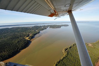
Winter's heavy rains bring us higher river flows, which means lowered salinities in Puget Sound and coastal bays. This influx in cool water doesn't seem to be making much of a difference in water temperatures however. Puget Sound waters remain at record-breaking highs.
It appears 2015 may not be our only
year of the jellyfish. We saw large patches of jellies in the southern finger inlets of the Sound. Also, signs of phytoplankton blooms are already visible in coastal bays.
As you can imagine, winter weather can make it very difficult to find a good day to fly. When we can't take to the skies our research boat, the Skookum, gets the job done!
What's Eyes Over Puget Sound?
Eyes Over Puget Sound combines high-resolution photo observations with satellite images, ferry data from travel between Seattle and Victoria BC, and measurements from our moored instruments. We use a seaplane to travel between our monitoring stations because they are so far apart. Once a month, we take photos of Puget Sound water conditions and turn those out, along with data from our stations, in the monthly
Eyes Over Puget Sound report.


No comments:
Post a Comment