
We’re keeping an eye on warm temps and snowpack
As each winter progresses, water managers in our state begin to look critically at the mountain snowpack in the Cascades, Olympics, and headwater areas feeding Washington’s rivers and reservoirs.We’re keeping an eye on La Niña conditions and how the water year will stack up. Will there be enough water for irrigators? How will municipalities fare and what actions should we take if supplies might fall short of our needs? Where is all the snow?
These are questions Ecology’s Water Supply Availability Committee (WSAC) considers as we monitor wintertime snowpack development and water availability.
Mid-winter update
With that in mind, we offer this mid-winter update on how snowpack is doing across the state, and what the rest of the winter may look like.At our next WSAC meeting on Feb 2, 2018, experts will share their technical assessments of where we stand, including perspectives from the Office of Washington State Climatologist, U.S. Geological Survey, National Weather Service and its Northwest River Forecast Center, Natural Resources Conservation Service, U.S. Bureau of Reclamation, U.S. Army Corps of Engineers. Bonneville Power Administration, City of Seattle and other municipalities.
Hopefully by that time it will be more apparent whether the region will reap any benefit from a cold-phase La Niña, or whether we’ll experience more of the same, characterized by fits-and-starts and less reliable snow in the mountains.
The good news for Washington is that the snowpack on January 1 is a positive, first-order correlate of April 1 snowpack, which means that the likelihood of having an around-normal April 1 snowpack is decent.
Temperatures
Perhaps the most pronounced hint for how this winter may turn out are the above-normal temperatures, particularly at night, and the lack of low-elevation snow. This doesn’t square with the “expected” cold-phase La Niña pattern, where we in the Pacific Northwest endure a long, cold, and quite snowy winter.I put quotes around “expected” because the regional response to the El Niño-La Niña see-saw (El Niño-Southern Oscillation, or ENSO), both in Central Washington and the Pacific Northwest at large, doesn’t per se follow regular El Niño = warm/dry, and La Niña = cold/snowy patterns.
Generally we can expect such things, but the atmospheric response to cooler sea-surface temperatures in the equatorial Pacific varies on a number of factors here in western North America. This year we’ve seen a persistent high-pressure ridging west of California and Oregon. The same ridging has been nagging California for most of this decade, and also correlated with the region of anomalously warm water that folks at the Office of the Washington State Climatologist coined the “The Blob.”
Closer to home, the upper Yakima Valley has consistently been experiencing warmer-than-normal daytime and nighttime temps since the beginning of November. Temperatures taken at the Yakima airport give some perspective on the relatively mild winter in a normally-cool region of the state:
Daytime high temps are above-normal
- November normal daytime high is 47.9F; this year the average high was 50.1F (2.2F above normal).
- December normal daytime high is 35.8F; this year the average high was 38.5F (2.7F above normal).
- January normal daytime high is 36.9F; as of Jan 16 this year the average high so far is 43.3F (6.4F above normal).
- November normal nighttime low is 26.8F; this year the average low was 32.3F (5.5F above normal).
- December normal nighttime low is 21.3F; this year the average low was 25.3F (4.0F above normal).
- January normal nighttime low is 22.5F; this year average low so far is 31.9F (9.4F above normal).

Precipitation
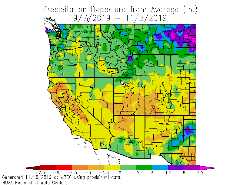
Another aspect of this weak La Niña is the relative lack of precipitation, particularly in the Yakima Valley and eastern slopes of the Cascades—areas of the state with a large demand for irrigation water to grow tree fruit, grapes, and hops. In fact, many areas of the western US, even all the way out to the Great Plains, are also below normal for precipitation so far this winter. Northern California and western Oregon are particularly lean.Fortunately, the western Cascades and Olympics seem to be an exception, and have above-normal precipitation for the last 60 days, as illustrated by this map:

(Source: https://wrcc.dri.edu/cgi-bin/anomimage.pl?wrc60dPdep.gif)
Check out other maps illustrating anomalous precipitation and temperatures.
Regional and Westside snowpack
SNOTEL sites, which provide automated measurements of snowpack conditions in the mountains, give us a workable picture of how winter is progressing in the mountains. So far, accumulation in Washington mountain ranges has been progressing steadily, if not exactly hitting it out of the park.For Washington:
- Washington’s snowpack is in relatively good shape, considering warmer temperatures.
- Westside basins are also struggling with above-normal temperatures; Central Puget Sound mountain snowpack is 74 percent of normal, South Puget Sound is 70 percent of normal, and Lower Columbia at 65 percent of normal.
- Basins in northern Washington are near-normal, ranging from 93 percent in the central Columbia to 114 percent of normal for the upper Columbia. Good news for the Columbia, Nooksack, and Skagit (north Cascades/north Puget Sound is at 109 percent of normal).
- Upper Yakima is at 81 percent of normal, lower Yakima is at 82 percent of normal. This could use some improvement.
- The Olympics are at 91 percent of normal, but that number can be misleading since the three SNOTEL stations which make the basin average are clustered together on the NE side of the range, and in the rain shadow.
- Check out this map showing current snowpack conditions for major river basins in Washington.

The Upper Yakima snowpack feeds reservoirs around Snoqualmie Pass, Roslyn and Cle Elum, supplying water to farms downstream. While current reservoir levels are high enough to be encouraging, they are not necessarily a reliable indicator of summer water supply. In water years expected to be lean the Bureau of Reclamation, which manages the reservoirs in the Yakima Basin, may hold water back that would ordinarily be released with the knowledge that thin mountain snowpack will not replenish to the same degree as a normal year.
Other areas around the Northwest:
- North Idaho basins are right around normal. Good news for Washington rivers.
- Snake River basins in southern Idaho are lean, ranging from 38-104 percent of normal at the extremes, with most hovering between 55-75 percent of normal. Snake River headwaters, however are in relatively good shape; Teton at 99 percent and Snake Basin above Palisades at 111 percent.
- Oregon continues to be in a precarious spot, with most basins well-below 50 percent of normal. Many are nearly 30 percent of normal.
It is certainly still possible for Oregon to catch up to a less-severe snowpack situation, but becoming more difficult as we move into the prime part of winter.
A colorful and informative map of current snowpack conditions is updated daily by the Natural Resources Conservation Service’s National Water and Climate Center, and during this winter clearly illustrates the comparatively good position Washington is in when compared to more southerly states influenced by the offshore high pressure ridge.
Isn’t this a La Niña winter?
Sort of. Much of the fascination with La Niña winters, particularly among skiers, is the idea that ‘cold phase’ of the El Niño-Southern Oscillation provides cold temperatures with plenty of precipitation. This also gives water managers a huge advantage, since an above-normal snowpack mitigates summer water pressures for farmers, cities, and rivers.Certainly from the perspective of sea surface temperatures in the equatorial Pacific Ocean, we are in cold-phase La Niña territory, though not as much as had been discussed this past autumn.
Forecasters frequently use the Niño 3.4 region of the Pacific acts a gauge of sorts for El Niño and La Niña weather patterns. Currently temperatures in Niño 3.4 are shy of -0.8C (-1.5F) below the long-term average, which is indicative of cold-phase La Niña.
The threshold for El Niño events is a persistent monthly sea surface temp +0.5C above normal; for La Niña it is -0.5C below normal. Niño region 4 located further west in the Pacific, however, may be a stronger statistical determinant of La Niña winters, and that particular region isn’t showing temperatures cold enough to produce a strong La Niña winter.
Add to that the ridging keeping Oregon dry and British Columbia flush with snow, and you have Washington caught in the middle contending with a fits-and-starts variety snowpack we have had so far.
Is the Blob back?
Not yet.Does this mean we are having a drought?
So far we are looking to be in decent, but not quite great shape. We are getting precipitation, though not optimally timed or at the right temperature, and the mountains are in far better shape than in 2015. But we aren’t out of the woods quite yet.Ideally, cooler temperatures will arrive and provide snow at lower elevations, where (because of greater land mass) the Cascades tend to best collect a buffer for summer stream flow and water supplies. Climate and weather modelers familiar with the region’s weather are confident that winter as we know it during cold Niña is arriving, and that the forecasted unsettled weather for the coming week is a harbinger of a wet Feb and March.
See Cliff Mass’s January 13 Weather and Climate blogpost topic, which says:
“... I have some very good news for skiers and snow lovers: a major shift in the hemispheric flow patterns will result in much cooler/snowier conditions over the Northwest next week. And much wetter over California.
Finally, we will see a more La Niña-like pattern, something that typically occurs in early January when a La Niña is in place, as it is this year.
The flow pattern this week will bring substantial precipitation to the West Coast, importantly including California. We will cool down and substantial mountain snows are expected.”
Dr. Mass also points out that it is “good for water resources."
Agency water supply managers are in regular dialogue with the Office of the Washington State Climatologist on the likelihood of trend towards a cooler/wetter winter, and on whether western US states are in for a late start to above-normal precipitation.
Traditionally February and March are also the months with the greatest snow accumulation, regardless of Niño status. Hopefully this climatology bears out and we have abundant snow in the Cascades over the next 10 weeks.
By Tyler Roberts
Watermaster for Ecology's Office of Columbia River
1 comment:
Several of us WebExed into the NOAA West Watch meeting on 23 January and it was interesting to see that despite the typical La Nina cold anomaly along the equator, that there was a warm blob around California driven at least partly by Atmospheric Rivers (ARs) pushing warmer tropical air in that direction from the SW. What is typical for La Nina is the resultant zonal pattern of colder air in the northern US latitudes and warmer air in the south. What is less common, is that the west coast is so warm, perhaps the warm blob?
- Skip
Post a Comment